
The day ends with us us making the stunning drive down to the south coast past some of the most fertile land in the country. Farms and horse studs dot the landscape with their white walls and red roofs. Our destination is Seljalandfoss waterfall beyond these fertile low lands where the highlands come down to a long winding range of coastal cliffs formed eons ago when the sea level was 100m odd higher than today. This creates a serenely unique vista of 100m cliffs with cascading waterfalls for the next 200kms. We spent the night at Seljalandfoss where there was 3 spectacular waterfalls down these cliffs, sun light streaking through the multitude of storm clouds and cells out to the west and the sea. There beneath us on the far edge of the campground sat a playground backlit by the stunning vista…lonely yet beautiful and happy. Beckoning to be played upon by the joyful.
We climb a waterfall and walk the cliffs for several hundred yards to explore. The main waterfall you can walk behind and is supposed glow golden in the sunset which is unfortunately hidden beyond the storm cells to the west.
Its another wild night with constant rain and winds, and a sleet rain of hail to disturb the peace. We wake up and manage a hot breakfast of eggs on toast. Standard.
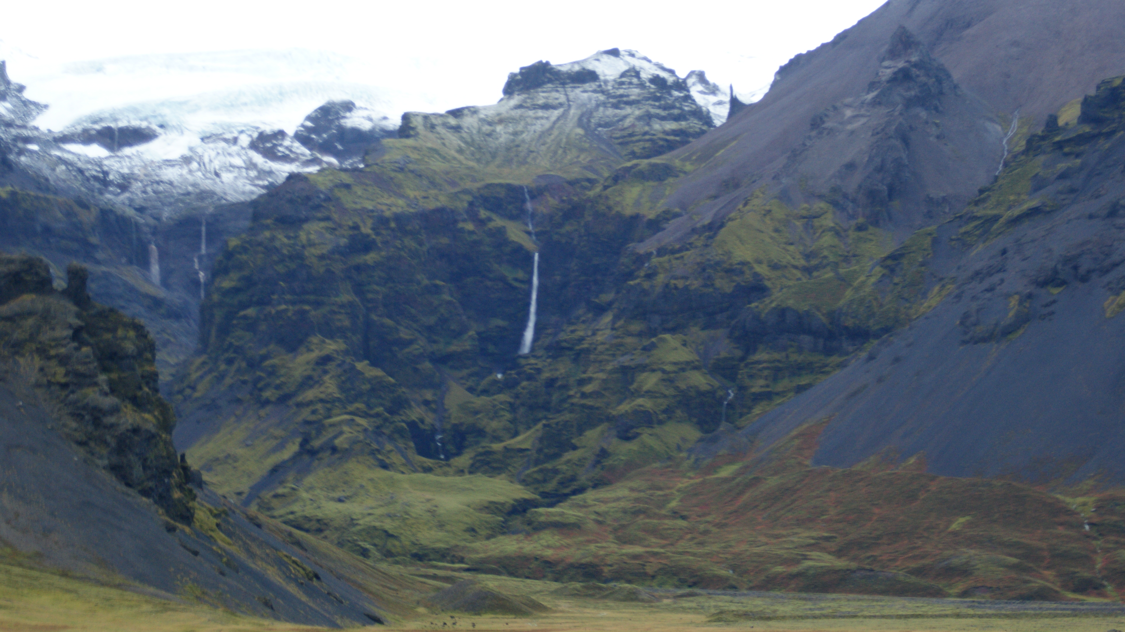
A short drive along find us on our way to a secluded valley with hot springs. No doubt this place has a name, but we don’t know it and it isn’t covered on any map. From the end of a gravel road we hike 20 min into the valley where no less than 26 waterfalls among snowcapped mountains in a 180 degree panorama stand before us with some hot springs at out feet. the only problem is its a large pool with a small inflow and as a result it is a touch cold. However we enjoy the scenery and the waters before making a swift exit to the sunshine down in the the valley whence we came in…just as a few others arrive.
Skogafoss waterfall is around the next bend – a 60m giant with a heavy flow set just beyond the picturesque town of Skogar – a larger farming village of around 25 people. Its remarkable how almost all the the farms we pass for the next hundred or so km are backed on to their own private waterfalls. We climb a staircase beyond Skogafoss to look down upon is might spray and up into the highlands beyond where the first of the icecaps are visible in the distance.
We snack a lunch and venture on the ring road – wedged
between cliffs on the left with constant cascading waterfalls and the black sands of the ragged coast on the right with the next town Vik, far in the distance.
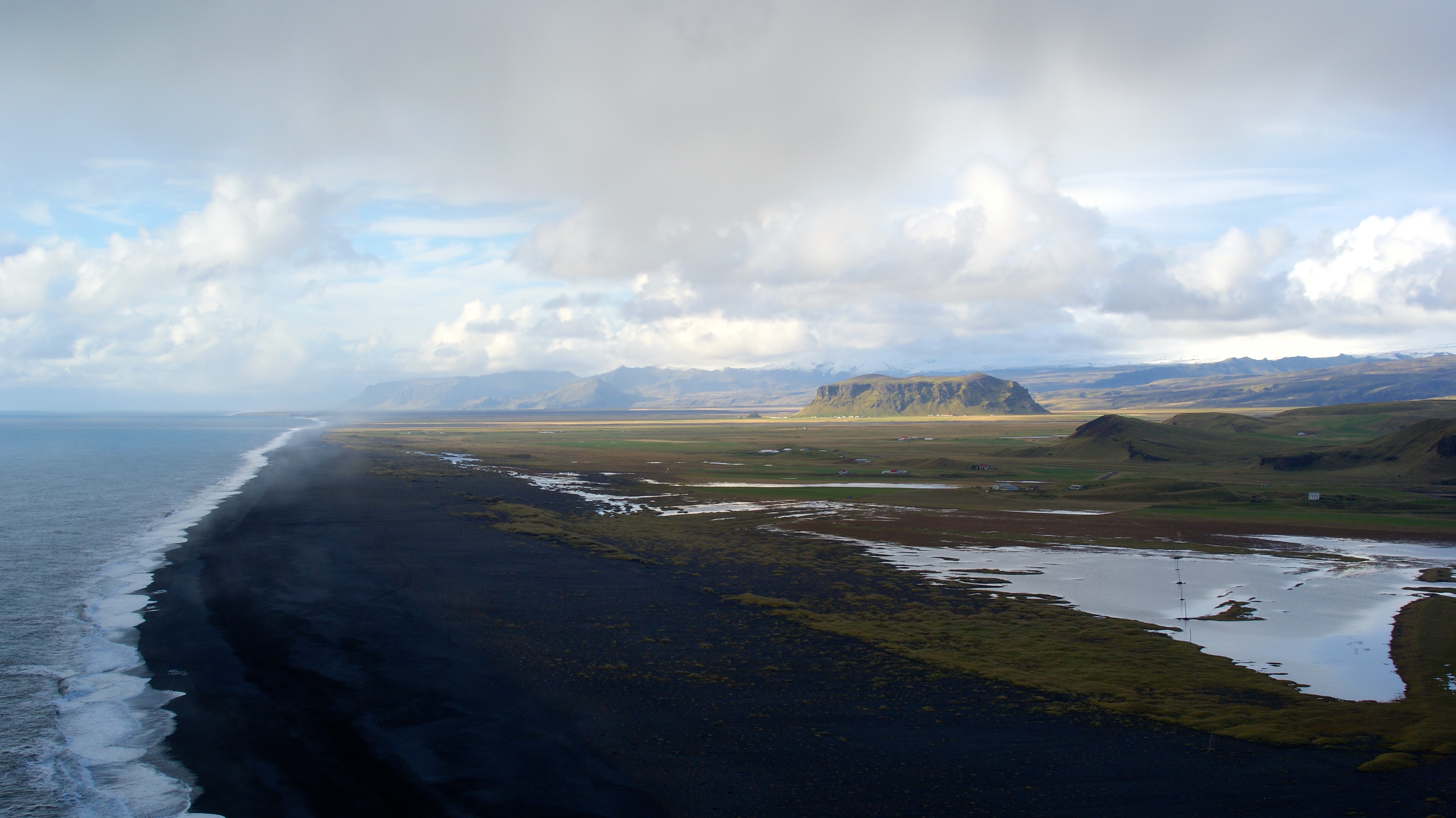
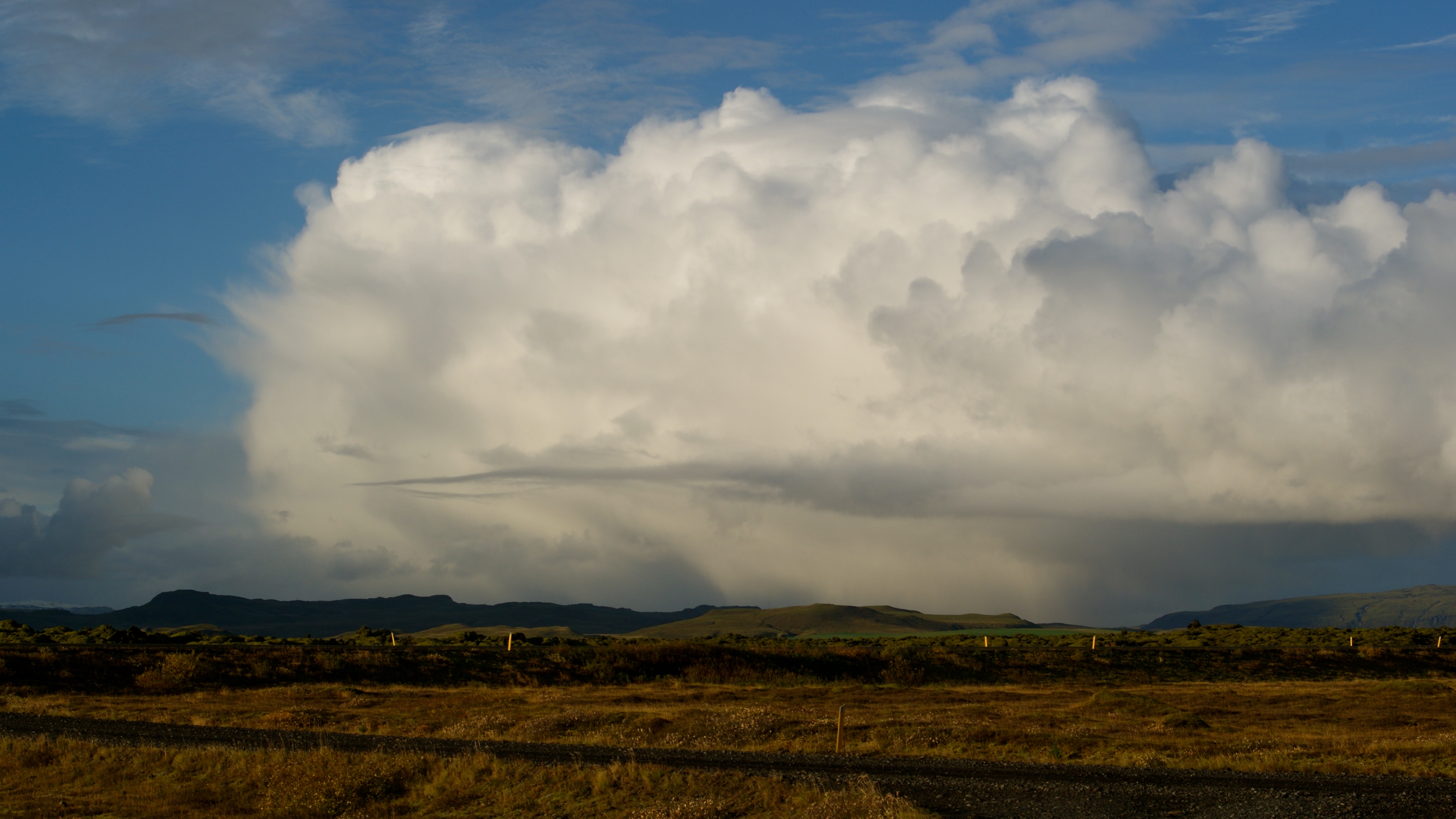
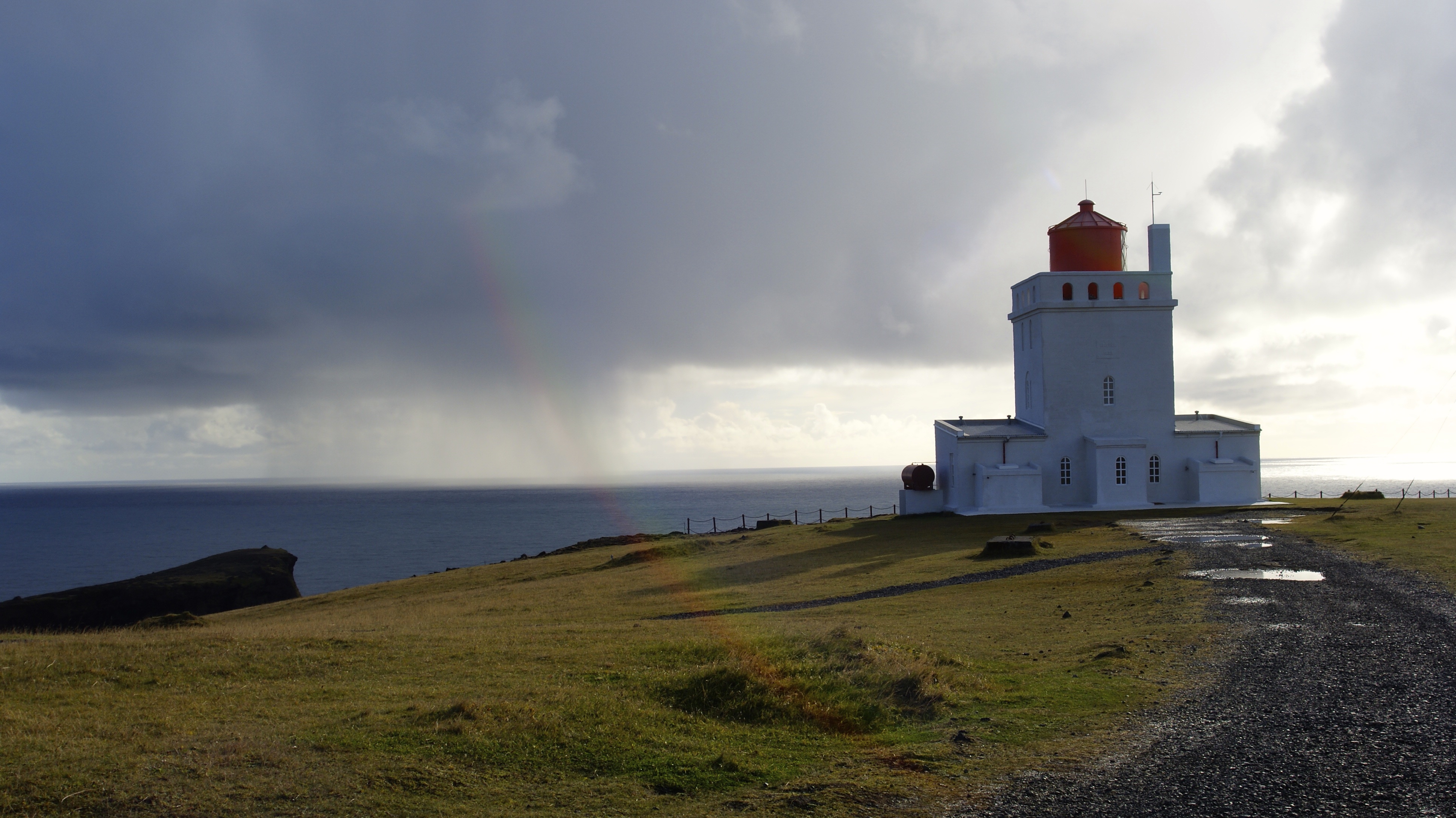
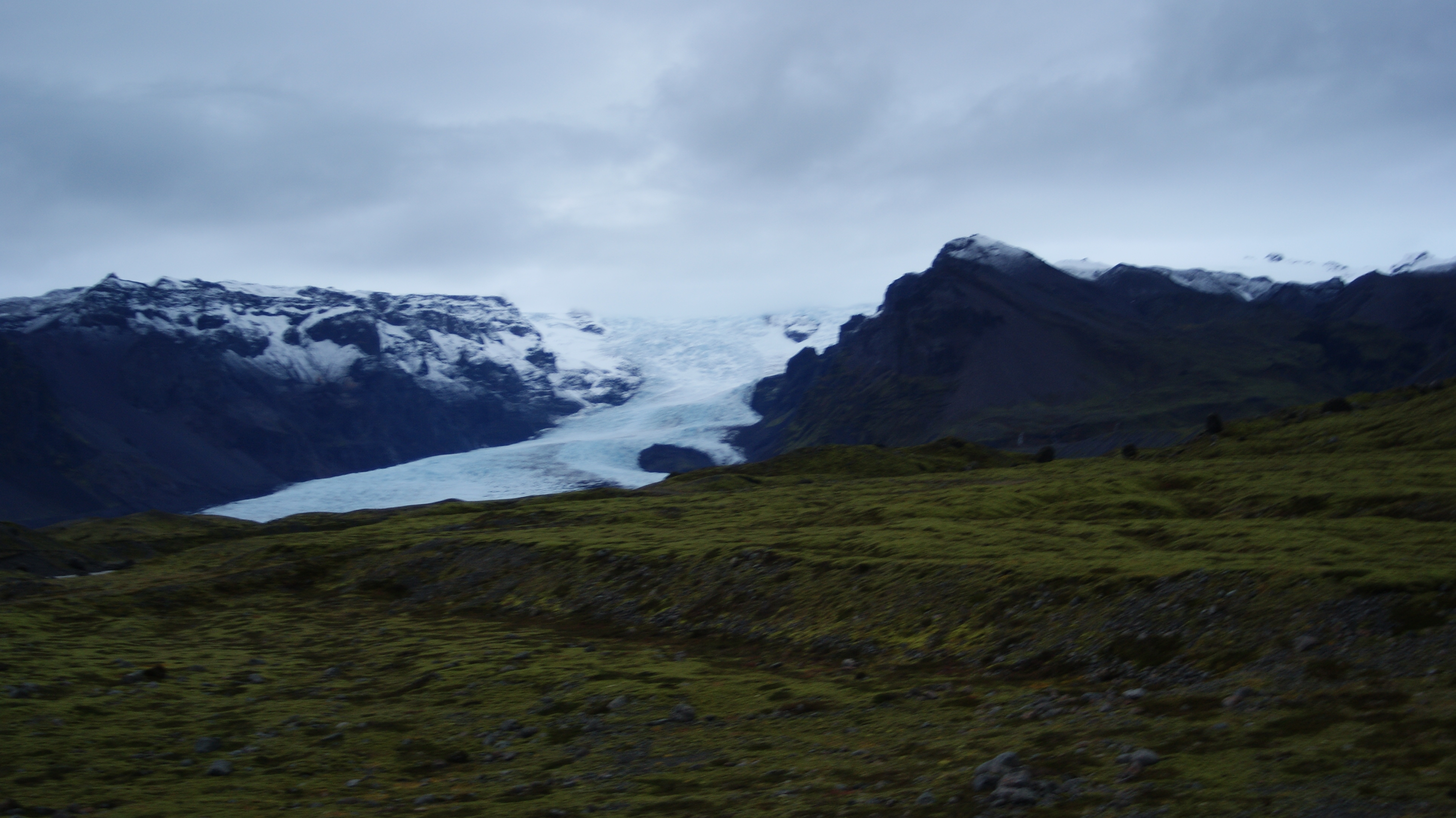
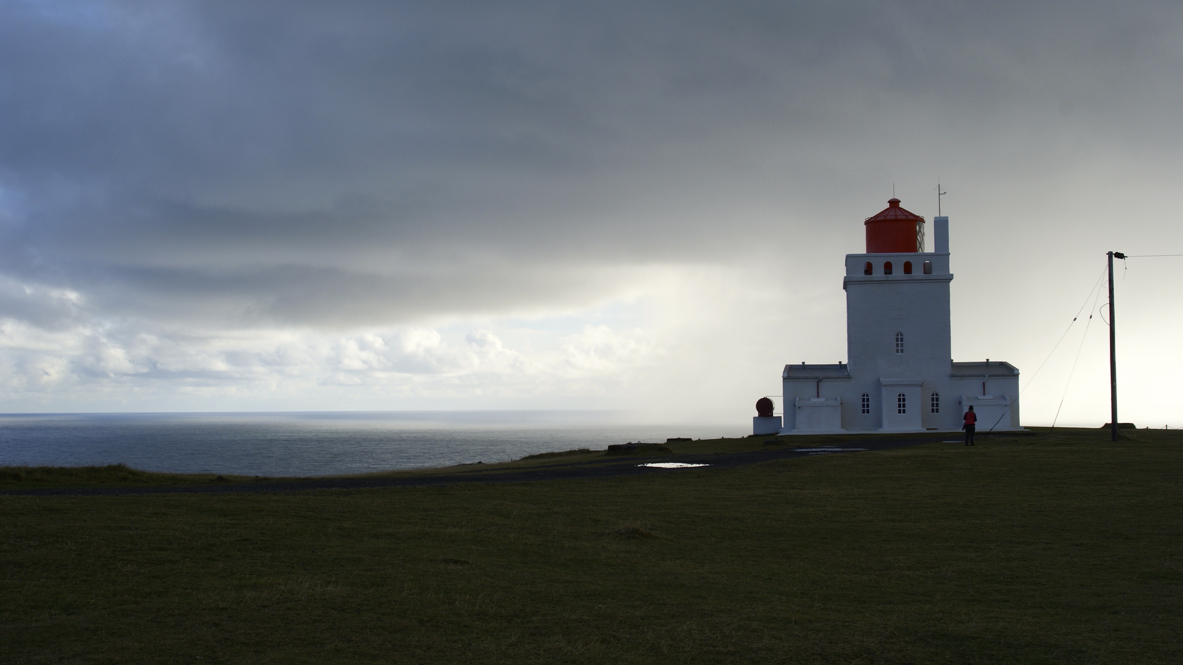
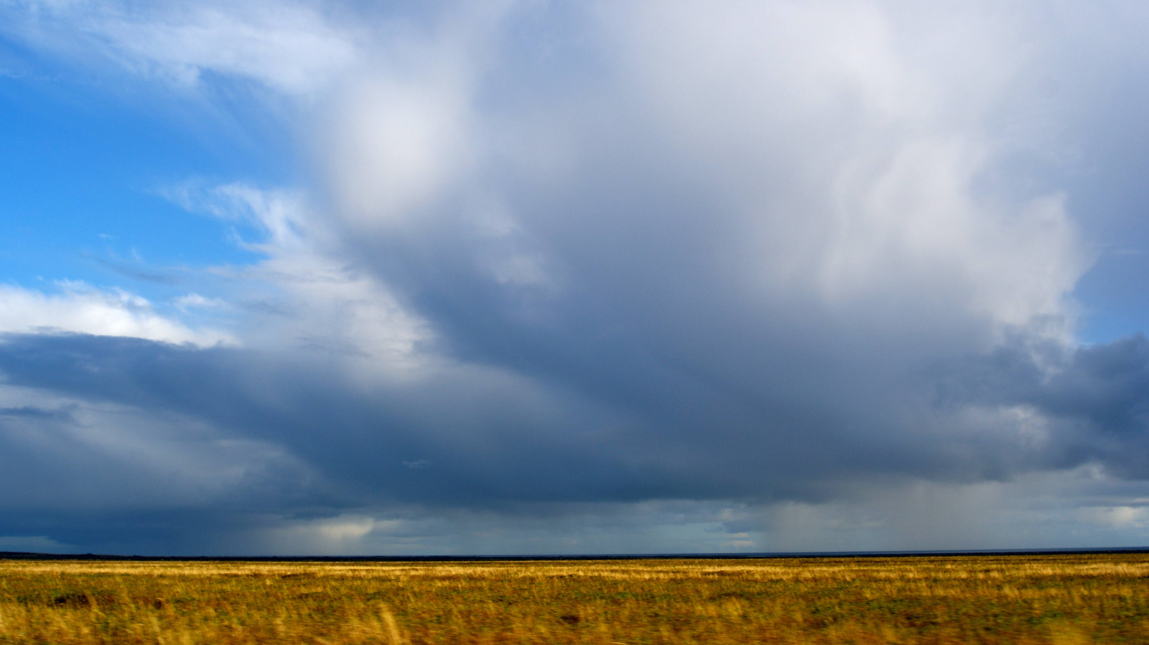
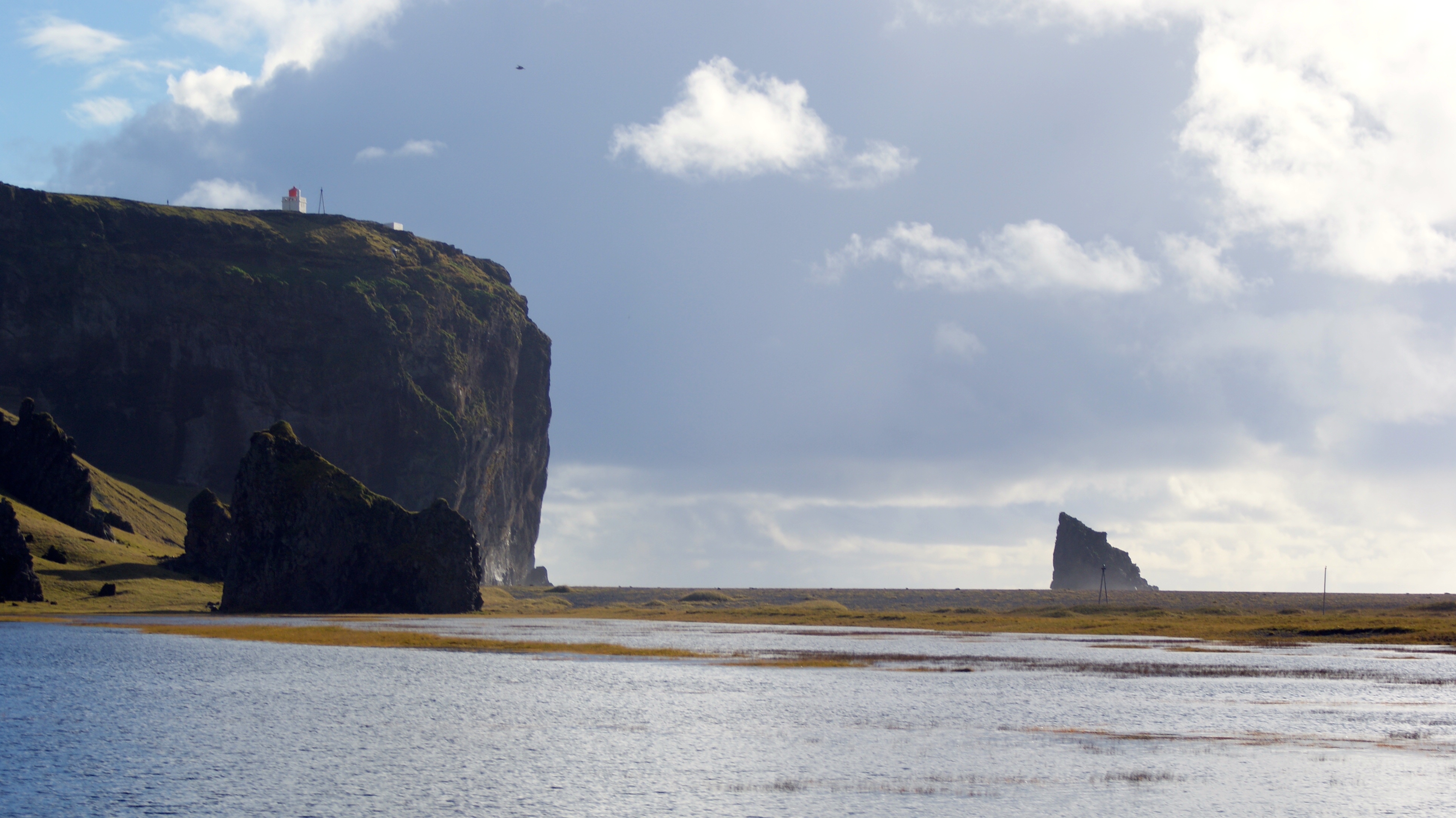
Around 30km short of Vik, with the town sight on the horizon we happen across a grand glacier and open a lighthouse at icelands most southern point. Perched high up on a headland that stands out from the flat surrounds and capped with a red toped lighthouse this is a panorama for the ages. 360 degree views assault our senses. On the coast side storm cells of wicked clouds and rain blot the sunshine into splotches, where back and forward the coastline ends in ragged cliffs and mountain panoramas. This is all overseen by snowcapped mountains peaking with the Myrdalsjokull icecap 50km in the distance like a grand overload. We sit, enjoy blissfully at peace in the grand world around us.
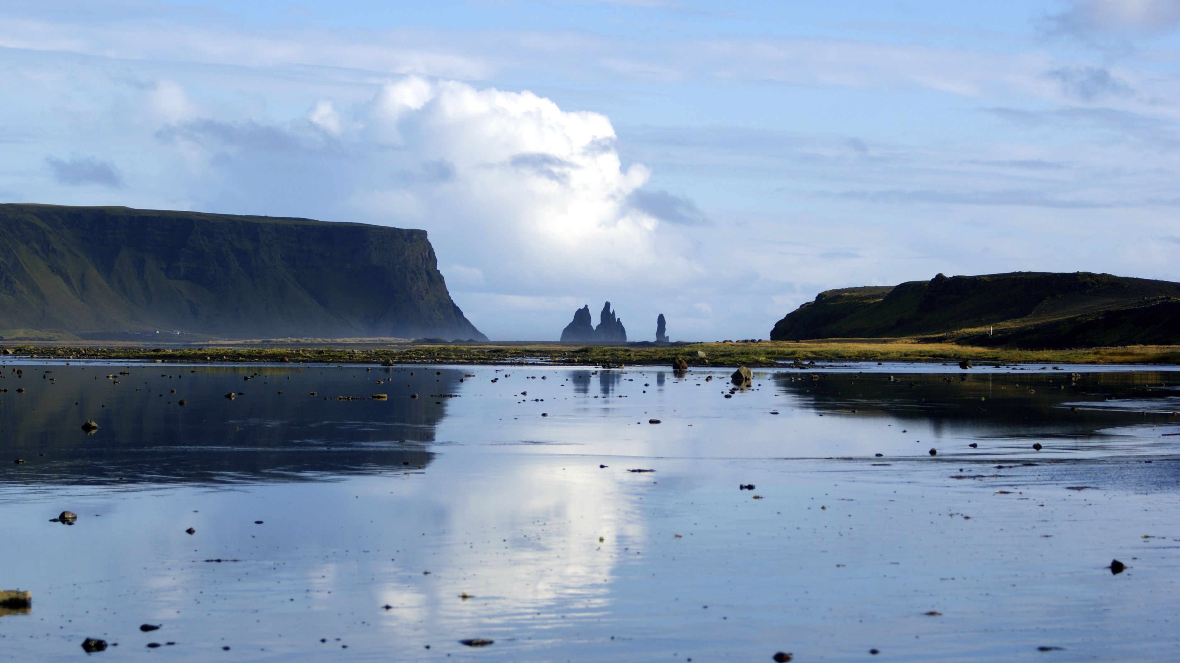
Vik is not much …another quaint seaside town with an idyllic church set aside the cliffs and the rolling green hills. We pass quickly as the sun is shining the theres along way to go.
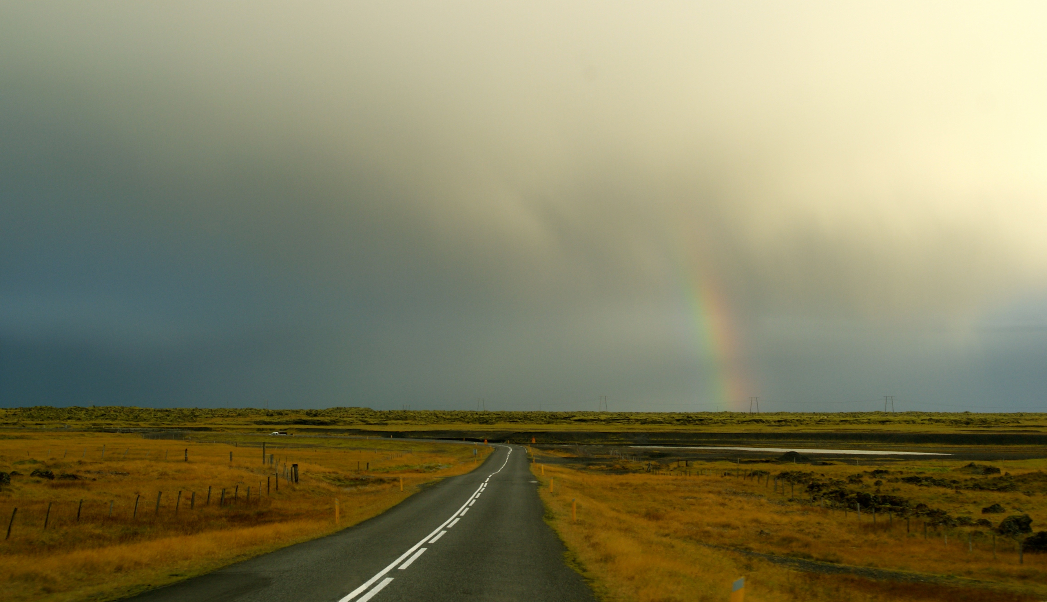
We bomb along the south coast at a 120. the max speed limit on this island is a meager 90 even on the best stretches of road, but its clear open, traffic free and good going. as if i could slow down.
Iceland’s south coast is a wonderful geological formation of the highlands coming down to a long range of cliffs that all positively cascade with waterfalls at around 60- 100m, before they flatten to some final low lands and then a rugged atlantic coastline. these cliffs for formed long ago when the sea levels were much higher and as they lowered left us with this pristine wonderful wilderness.
We round the corner of vik at the very southern end of the island and just beyond the 4th largest icecap of Myrdalsjokull and enter a wasteland of lava flows. These lava deserts are created by glacial floods caused by eruptions under the icecap and it is an erie scene at parts that looks hazardous and lifeless. The weather is utterly magnificent – bathed in sunshine for the majority, there are windswept storm cells cascading to the right hand side out to sea and a gigantic glacier flowing down to the left. Beyond the first 40min we enter the lava badlands – a weird formation of lava runout covered in moss where we term the poo lands as we make a bathroom stop on the side of the road to find every crevice filled with a sneaky batch of tp. Iceland needs to better its amenities.
Beyond the horizon the weather turns as the ever changing scenery continues – the storm cell we find ourselves in the midsts of merely adds to the mystery of this land. We crest a ridge now on the corner of Vatanjokul – Europe’s largest icecap and a positively enormous terra structure that has dozens of the biggest glaciers you will ever lay eyes upon flowing out down to the south east coast. We make good time and call night fall at Jokulsarlon


